 Dedication
Ilankai Tamil Sangam
Association of Tamils of Sri Lanka in the USA
Published by Sangam.org
by Sachi Sri Kantha, June 8, 2010
|
While scanning the details presented in this gazetteer, I noticed the following: (1) In the span of 75 years, quite a number of place names with Tamil origin have become ‘Sinhalaized’or (a better word is) bastardized. While my choice-word ‘Sinhalaized’ doesn’t exist in the English dictionary, the word ‘bastardized’ is authentic and has a definition that means ‘corrupt or debase (something such as a language or art form) typically by adding new elements. This ‘Great Tamil-Name Robbery’, aided by the government institutions, is still in progress. (2) Ecological beauty of some locales has been vandalized, beyond return to their pre-independent days, or even pre-1980 period. (3) Quite a few locales have been sports-hunting sites for the British colonial officers, planters and natives who owned guns and automobiles. (4) Quite a number of locales were LTTE landmarks for camps, battles and associated paraphernalia, for 30 years from 1979 to 2009 among Tamils. (5) Most notably, quite a number of historical snippets mentioned in this gazetteer do not appear in current editions of tourist information books and maps on Sri Lanka, produced by multi-national publisher barons such as Berlitz travel guide and Lonely Planet guide to Sri Lanka. |
Dedication
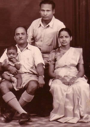
Some locales mentioned in this primer (Mankulam, Mullaitivu and Vavuniya) are dear to me as I spent five of my childhood years (from 1955 to 1959) in these spots and began my early schooling there. I dedicate this article to the memory of my maternal grandfather Arumugam Thiyagarajah (1910-1982), whose birth centenary I honor this year. He was born on May 2, 1910, and was a pioneer farmer cum hunter who knew this territory in his fingertips. I have only a single photo of me (as a 7-months old toddler), sitting in his lap, with my parents.
Introduction
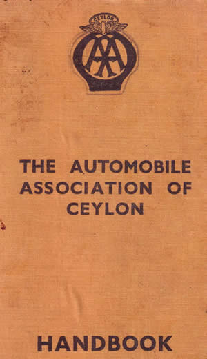
The Automobile Association of Ceylon (Colombo) was first established in November 1904. In my Sri Lankan book collection, I have an old gazetteer The Automobile Association of Ceylon Handbook, published by the Automobile Association of Ceylon. Neither the author/compiler nor the publication year is mentioned in this book. But, from internal factual evidence and citations to Motor Car Ordinance of 1935 presented, I could infer that this gazetteer should have first appeared in around 1935. This makes the book 75 years old. Interesting items relating to the locales and tips to game hunters and shooting enthusiasts in this book deserves a look.
First, to the dictionary definition of what is a locale? The New Oxford American Dictionary (2001) defines a locale as, ‘n. a place where something happens or is set, or that has particular events associated with it.’ Between pages 155-183 of this Automobile Association gazetteer, I find some interesting historical facts and folklore pertaining to Eelam locales in the North-Eastern province and the North-West region. Ever heard of the Baldeus Tree, the Judas Tree, the White Man’s Tree, Capt. Nolan, King’s House, and Hippuros mentioned by Pliny the Elder?
 Baldeus tree was a big tamarind tree [named in honor of Rev. Phillipus Baldeus (1632-1672), a missionary for Dutch East India Company who preached to the Tamil natives under this tree] located in Paruthi Thurai (Point Pedro) market square. This tree was uprooted by a cyclone in 1963.
The Judas tree, according to the same dictionary quoted above, is “a Mediterranean tree of pea family, with purple flowers that typically appear before the rounded leaves. Its botanical name is Cercis siliquastrum. Why it came to be known as Judas tree in Ceylon was that the pod has 30 seeds (!), that were eaten by ponies!
White Man’s tree is associated with British sailor Robert Knox (1641-1720), who was captured in 1659, and held captive in the island. Knox became the model for Daniel Defoe’s novel Robinson Crusoe (1719).
Notable Facts
While scanning the details presented in this gazetteer, I noticed the following:
(1) In the span of 75 years, quite a number of place names with Tamil origin have become ‘Sinhalaized’or (a better word is) bastardized. While my choice-word ‘Sinhalaized’ doesn’t exist in the English dictionary, the word ‘bastardized’ is authentic and has a definition that means ‘corrupt or debase (something such as a language or art form) typically by adding new elements. This ‘Great Tamil-Name Robbery’, aided by the government institutions, is still in progress.
(2) Ecological beauty of some locales has been vandalized, beyond return to their pre-independent days, or even pre-1980 period.
(3) Quite a few locales have been sports-hunting sites for the British colonial officers, planters and natives who owned guns and automobiles.
(4) Quite a number of locales were LTTE landmarks for camps, battles and associated paraphernalia, for 30 years from 1979 to 2009 among Tamils.
(5) Most notably, quite a number of historical snippets mentioned in this gazetteer do not appear in current editions of tourist information books and maps on Sri Lanka, produced by multi-national publisher barons such as Berlitz travel guide and Lonely Planet guide to Sri Lanka.
73 Locales
To preserve the historical records, I have transcribed below the historical facts and folklore records of 73 locales below. [Following abbreviations had been used in the book: EP – Eastern Province, NP – Northern Province, NWP – North-Western Province. Note that the English spellings presented in the book have been retained.]
Allai: EP, 4 miles south of Mutur Resthouse on the Trincomalee-Batticaloa road. Here is an important tank, irrigating over 2,600 acres of land which was reported on by Mr.M. Kelway Bamber, agricultural chemist, as suitable for sugar cultivation. Good shooting area.
Arippu: NP. On the north-west coast, about 15 miles south of Mannar. Here Robert Knox arrived after his adventurous escape from Kandy in October 1679.
Arugam Bay: EP. 68 miles from Batticaloa on the east coast road. This is a health resort for residents in the malarious inland areas, (such as the Moneragala planting district), with its fine sea front and facilities for sea-bathing; while there is good sport to be had in the vicinity.
Batticaloa: EP. Capital of the Eastern Province. 84 miles south of Trincomalee. Resthouse. Old Dutch town with ruins of a fort. The Dutch first landed here in 1602; and in 1638, after defeating the Portuguese admiral Westerwold, concluded a treaty with the King of Kandy. In the lagoon which practically sounds the town, may be heard, on a moonlight night, the so-called ‘singing fish’, which have not been identified as yet. The ‘singing’ is best heard from a boat, by placing to the ear an oar or a walking stick dipped in the water. There is a local cloth-weaving industry, and good sport can be had in the country around, where vast tanks and extensive tracts of paddy are to be found. Batticaloa is now connected by rail with Colombo, and the old Kalladi ferry has been replaced by a bridge. The vernacular name of the place is ‘Mada-Kaluppuwa’.
Chilaw: NWP. Resthouse. It is a progressive town, and the centre of a flourishing coconut industry; some of the finest estates lying in this area. The famous Munnessaram Temple (Sivite) can be conveniently visited from here. It contains ancient Tamil inscriptions and is a place for pilgrimages.
Cottiar (more correctly Koddiyar): EP. South of Trincomalee, gives its name to Cottiar Bay into which the Mahaweli Ganga empties itself. The French were, in 1672, granted permission by the Kandyan king to erect a fort here. Later the Dutch, under Admiral Goens, attacked and defeated the French, who evacuated the fort and set sail for the Coromandel coast. The ‘White Man’s Tree’, where Robert Knox was taken prisoner in 1660 is near here. Pigeon shooting.
Delft: NP. The largest of the islands lying to the west of Jaffna some 25 miles from the mainland; so named by the Dutch after the town in Holland. It was the venue of horse-breeding operations from very early times; but in 1906 the breeding establishment was closed down, though there are still horses to be found breeding promiscuously in the Island. Much interest still attaches to Delft, chiefly associated with Capt. Nolan, who exercised a kind of feudal lordship over the inhabitants, and of whom there are so many strange stories still told. The Baobab tree is to be found here as well as in Mannar. A motor launch now runs between the mainland and Delft fairly regularly. Crossing is usually impossible during the South West monsoon.
Elephant Pass: NP. 166 miles from Kandy, 28 [miles] north of Mankulam, and 32 [miles] from Jaffna. A favourite resort for sportsmen; waterfowl and partridge. The Resthouse was once a Dutch fort. Good fishing, October to January.
Eravur: EP. About 9 miles from Batticaloa. A Moorish village. There is a temple dedicated to Vira Badra, a Hindu malignant deity.
Inuvil: NP. 2 miles from Jaffna on road to Kankesanthurai. American mission, McLeod Hospital. Kandaswamy temple.
Iranaimadu: NP. 45 miles from Jaffna. Large recently restored tank, by which cultivation is being fostered.
Iratperiyakulam: NP. 3 miles from Vavuniya towards Medawachchiya. Large tank. Inscription of Gaja Bahu I (AD 113-135).
Irakkamam: EP. Inland from Pulladiputti which is 31 miles south of Batticaloa. Tank 1,200 acres. Shooting.
Jaffna: NP. Resthouse. Jaffna surrendered to the Dutch after a siege of 3 months on June 22nd 1658, the same year that the Revd. Dr. Baldaeus introduced the reformed religion. In 1795 the British forces, under Col. Stewart, captured Jaffna. Average rainfall 49 inches, temperature 81oF. Nowhere in Ceylon is the Dutch influence more apparent. The fort contains ‘King’s House’, which serves as a residence for the Governor, and the church, dated 1706, is in a splendid state of preservation. Mr.J.P. Lewis thinks an older church stood on the site of the present church which contains tombstones as old as 1666 on the floor. On the road to Kayts are to be found remains of a Portuguese church and monastery. The Chiviateru salt pans are close to the town. South West of Jaffna is a group of islands, the chief of which is Delft. The people are industrious agriculturists and artisans. The palmyrah palm is cultivated in place of the coconut palm. Interesting curios in the shape of fans, baskets and beautiful gold filigree work can be purchased.
 Kalkudah: EP. Resthouse. 4 miles from Valaichena, 20 miles from Batticaloa on the road to Trincomalee. Good game centre. Excellent sea-bathing in front of Resthouse and also at Passikudah Bay, about a mile from Resthouse.
Kalladi: EP. About half a mile south of Batticaloa. Manning Bridge has replaced the old ferry.
Kallar[u]: EP. 21 miles south of Batticaloa. Causeway, originally a Dutch wall across the lagoon. There are the ruins of a famous Hindu temple here.
Kalmunai: EP. 25 miles south of Batticaloa. Resthouse, facing sea. Thriving small town. Sea-bathing. Mission (Wesleyan) station.
Kalpitiya (Calpentyn): NWP. 29 miles from Puttalam; turn off at Palavi, 4 miles from Puttalam. Kalpitiya, an old Dutch town, surrendered to the British forces on 5th November 1795. Old Dutch church and fort. Industries, coconut cultivation, grape growing, drying and salting fish. There is a railway station at Palavi on the Chilaw-Puttalam line. Resthouse.
Kankesanthurai: NP. Terminus of railway in the North. 11 miles from Jaffna. Resthouse, resorted to by invalids. An important port for small vessels. Lighthouse. Foundation of Portuguese fort to resist the invasion of the Maharattas. Point Kailmere is within 8 hours journey by dhony.
Kanniyai: EP. Half a mile off the main road, to the left, about 6 miles from Trincomalee, on the road to Anuradhapura, are the Kanniyai hot springs. The temperature of the water varies from 100 to 110oF, and the water is extremely free from salts. The Springs are named after Kanniyai, the Virgin mother of [King] Rawana. In order to prevent Rawana from starting on some adventure, Vishnu appeared as an old man and informed him that his mother was dead. In order to perform the rites for the dead the hot springs were made to burst forth for his ablutions.
Kantalai: EP. Resthouse. Tank 3,500 acres. Snipe, fowl and small game. Slate inscriptions of Nisanka Malla (AD 1187-1196). The tank was built by Maha Sena about AD 275, the bund is about a mile long, and 70 feet wide at the top.
Kappachchi: NP. 17 miles from Medawachchiya on the road to Mannar, turn left, 4 miles beyond Mankulam. Big game, peafowl etc.
Karaitivu: NP. Island 11 miles from Jaffna town, over causeway. Ferry to Kayts 60 cents. Numerous ruins of stone buildings exist in the neighbourhood.
Kathiraveli: EP. 40 miles from Trincomalee going south and 44 miles north of Batticaloa. Resthouse. Good shooting centre.
Kattankudi: EP. A populous Moorish village, 3 miles from Batticaloa, going south.
Kayts island: NP. 14 miles from Jaffna, via Karaitivu. Resthouse. Important port for small ships. Interesting old Dutch Fort, ‘Hammenhiel’, on little island at entrance to harbour. By boat to Jaffna, 12 miles.
Kinniya: EP. 9 miles from Trincomalee on the coast road to Batticaloa. Ferry. Tampalagamam window-pane oyster fishery.
Kirimalai: NP. 2 miles from Kankesanthurai. Sivite temple. A tank has been built round a fresh-water spring on the sea shore. This is a sacred place for bathing for Sivites, and for performing other ceremonies.
Koddaimunai: EP. 1 mile north of Batticaloa, at turn-off Batticaloa Bar.
Kodikamam: NP. 4 miles from Chavakachcheri. Railway station. Road to Point Pedro starts here, distance 11 miles.
Kudremalai: NWP. (The Horse Mountain). North of Puttalam, reached by boat from Etalai or Kalpitiya. Referred to by Pliny (Lib.VI. Cap.22) as Hippuros. Here there is a tomb to a saint in a small mosque – a place of pilgrimage to Mohammedan navigators, who in passing made offerings at the tomb to ensure a safe passage. Traditional site of a Roman palace once occupied by Princess Alliarasany, whose amorous intrigues with one of the heroes of the Mahabharatha constitute the subject of an interesting drama.
Madhu: NP. On the road from Medawachchiya to Mannar. There are festivals held at the Roman Catholic Church at Madhu, the greatest of which takes place on July 2nd and is attended by twenty to thirty thousand persons from all parts of the Island. The Catholics have great faith in the power of healing which is associated with this place.
Mankeni: EP. Between Kathiraveli and Chenkaladi on road from Batticaloa to Trincomalee, 19 miles north of Chenkaladi. Shooting centre.
Mankulam: NP. Resthouse. 61 miles north of Anuradhapura. Turn-off to right to Mullaitivu. Good shooting centre (Not to be confused with Mankulam, 9 miles from Medawachchiya on road to Mannar).
Mannar: NP. Resthouse. 53 miles from Medawachchiya. Causeway extending 2 miles from main land. Tennant describes it as, ‘sterile and repulsive covered by a stunted growth of Umbrella trees and Buffalow thorns’. ‘A sandy and inhospitable country’, says Bella Sydney Woolf. There is however, some interest in the place which contains a Dutch Fort and a number of Baobab trees, probably brought over from the African coast by Arabian traders in days of old. The circumference of some of these Baobabs is over 30 feet. The fruit, which is eaten by ponies, has 30 seeds, and this has given the Baobab the name of ‘Judas Tree’. In ancient times Mannar was the emporium of Mahommedan commerce, and carried on trade with Arabia, Egypt and the Mohammedans of the Mediterranean and Spain.
Mantota[m]: NP. This is the ‘Mahatittha’ of historians, which was the port for many war-like and other adventures in early Sinhalese history. Here are some ruins said to be those of a city founded by Elala, about 200 BC, including those of a famous temple dedicated to Tirukesvaram (Vishnu). Mantota is east of Talladi, which is 2 miles from Mannar on the mainland.
Marichchukaddi: NWP. The centre of the pearl fishery. 42 miles from Puttalam and about 30 miles from Mannar. North East of Kudremalai. The oysters occur most abundantly on rocky ‘paars’ or banks in 5 to 9 fathoms of water, where they lie attached by their ‘byssii’, or cables (not present in the edible oyster). These paars extended all along the Northwest coast, but the only important ones are the Cheval and Modragam Paars, which are better protected from weather and currents. Fish, snakes and skates are destructive to the young oysters, which are also liable to be carried away into deep water by currents and covered by drifting sand. The oldest reference to the Ceylon Pearl Fishery occurs in the ‘Mahavassa’, where King Wijeya (circa. 550 BC) sent his father in law presents of chanks and pearls valued at 2 lacs of rupees. A characteristic of these fisheries is their uncertainty, and their intermittent periods of barrenness. The most profitable on record was in 1905, when the revenue brought in was 3.5 million rupees, of which the Government got a 2/3rd share. Chanks are also a source of revenue, and are fished off Mannar, and also (chiefly) in the shallow waters of the Palk Strait of the Jaffna Islands. They occur in appreciable numbers on the Pearl Banks where fishing is prohibited. About 3 million are obtained annually from the Ceylon beds. They are largely used in the manufacture of cheap bangles.
Mullaitivu: NP. Resthouse. 30 miles from Mankulam. A seaport, open between March and October. Salt industry. Seat of an Assistant Government Agent (AGA).
Mundumurippu: NP. On the Parangi Aru, turn left at Irampaikkulam, between Vavuniya and Puliyankulam. Good shooting, big game, fowl etc.
Munnessaram: NWP. 1 mile from Chilaw. Sivite temple. Tamil inscriptions. Notable place of pilgrimages.
Murunkan: NP. Resthouse. 38 miles from Medawachchiya on road to Mannar. Near Giant’s Tank, the retaining bund of which is 300 feet broad at the base, and can be traced for more than 15 miles. The spill itself is a wonderful piece of work.
Mutur: EP. Resthouse. 16 miles from Trincomalee on the road toBatticaloa. Near Mutur resthouse (~2miles), stands a White Man’s Tree. A tablet on the tree bears the following inscription, ‘This is the White Man’s Tree under which Robert Knox, captain of the ship Anne, was captured, AD 1660. This stone was placed here in 1893.’
Nallur: NP. 2 miles from Jaffna. Here is the famous Hindu temple Kandaswamy Kovil.
Nedunkeni: NP. On the road from Puliyankulam (about 11 miles) to Mullaitivu. Here occurred some years ago the heaviest local rainfall on record, some 24 inches in 24 hours. Good country for game.
Nilaveli: EP. 9 miles north of Trincomalee. Salt pans. Shooting. Nearby is a column of rock resembling a human figure, said to be a petrified body of a woman who offended the deity by defiling his sacred ground.
Olumadu: NP. 3 miles from Mankulam on road to Mullaitivu. Tank. Shooting.
Omantai: 8 miles from Vavuniya on road to Jaffna. Pillaiyar temple.
Ontachchimadam: EP. 18 miles south of Batticaloa on south road. Causeway. Brass-work industry of a special type.
Palakkuda: NWP. One road to the west leads to St.Anna’s Roman Catholic Church at Talawila, another to St.Anthony’s Church at Wattacholai 1 mile.
Palavi: NWP. 4 miles from Puttalam, towards Chilaw. Turn-off Kalpitiya.
Paraiyanalankulam: NP. On the Medawachchiya-Mannar road; big game, pea-fowl, etc. – large tank; ancient inscriptions, 1 mile north is Putayil Puttu (‘Mound of Buried Treasure’) dagoba. Resthouse.
Pesalai: NP. 11 miles from Mannar. Beacon, old Dutch tower, 3 miles. It was here that St.Francis Xavier first landed, according to tradition.
Point Pedro: NP. Resthouse. 21 miles from Jaffna, 14 [miles] east of Kankesanthurai; northernmost point in Ceylon, 2 miles west of Point Pedro. Port and Customs. Imports – chiefly paddy from India; Exports – tobacco, etc. Dry, salubrious climate, good fish. Sea-fishing possible. Sanitorium for people with weak lungs. Here is the Tamarind Tree (known as ‘Baldeus Tree’) under which Baldeus, who introduced Christianity into the Island, is said to have preached. He published a book on Ceylon, written in Dutch, and printed in Amsterdam in 1672.
Pomparippu: NCP. Resthouse. 24 miles north from Puttalam, along the coast-road. Resthouse. Ruins of many ancient buildings in the neighbourhood. Good waterhole shooting. Can be reached from Kalpentyn or Etalai, by boat.
Pottuvil: EP. 67 miles south of Batticaloa, 2 miles to Arugam Bay. Good shooting. New Resthouse at Arugam Bay.
Puliyankulam: NP. (Kallolunkan-Puliyankulam). Excellent game country.
Puttalam: NWP. Resthouse. 32 miles from Chilaw. According to tradition, Wijeya, first King of Ceylon (543 BC) landed here. Supposed to be identical with ‘Battala’, visited by Ibn Batuta in the 14th century. Salt pans. At one time, a pearl-fishery was held here. By canal to Colombo, 82 miles. Rainfall 45 inches. Good game country and coconut district.
Puttur: NP. Turn right at Chavakachcheri, 9 miles from Jaffna on the road to Point Pedro. The inexhaustible well, said to be some 24 fathoms deep, 14 fresh, and the rest salt, called ‘Nilavarai’, is 2 miles from here to the west, on the minor road from Chunnakam.
Puvarasankulam: NP. 9 miles from Vavuniya on the road to Mannar. Good camping place for sportsmen. Water plentiful.
Talaimannar Pier: NP. 8 miles from Pesalai (where the metal road ends), and 19 miles from Mannar. Terminus of railway and port for ferry-service to South India. From Talaimannar, a ridge of rocks called Adam’s Bridge extends to the island of Rameswaram, where there is a famous Hindu temple.
Tambalagamam: EP. To the right of the Dambulla-Trincomalee road, turn off 7 miles south of Trincomalee. The lake is famous for its window-pane oysters, the shells of which are used by the Chinese as glass-panes for windows. Scientifically this oyster is known as Placuna placenta. The pearls obtained, though abundant, are of no great value, being irregular in shape and lacking lustre. The shell is employed in the manufacture of cheap ornaments, and is sometimes burnt for lime (chunam) for betel-chewing. The oysters are found partially imbedded in the soft mud of the lake. The lake is leased to the highest bidder.
Tirukkovil: EP. Resthouse. 47 miles from Batticaloa on the road to Pottuvil. Sea bathing. Good fish. Shooting.
Trincomalee: EP. Two Resthouses, and 112 miles from Kandy and 66 miles from Anuradhapura. A naval station. Magnificent harbour. Swami Rock, 400 feet, on the top of which once stood a Hindu Temple. A place of pilgrimage for Hindus. Here may be seen a monument to Francina van Rhede, the daughter of a Dutch official, who, tradition says, became engaged to an officer, and, on his sailing away, flung herself into the sea. Fort Frederick, Dutch Point, Ostenburg Point etc. are full of interesting reminiscences. The town was captured by the Dutch in 1639, and taken by the British on 11th January 1782, only to be recaptured on behalf of the Dutch by the French fleet on August 31st 1782. On the 26th of August 1795, the British forces, under Col. Stewart, re-took Trincomalee after a siege of 3 weeks. Admiralty House stands on a little hill, and within its charming grounds is the famous gigantic Banyan tree, which, it is said, can give shelter to 1,000 people. There are several islands in the harbor, the chief of which is Sober Island, a popular resort for picnics. The country around provides excellent sport.
Tumpalancholai: EP. Good shooting. Road from here to Unnichchai Tank, 4 miles.
Tunukkai: NP. 13 miles west of Mankulam. (Mankulam on road to Jaffna not to be confused with Mankulam on road to Mannar).
Uppar[u]: EP. 12 miles from Trincomalee, on road to Batticaloa. Here is the estate of the same name, where Molesworth Brothers (one of whom was an astronomer, and the discoverer of Molesworth’s Comet) lived for many years.
Valaichchenai: EP. 19 miles from Batticaloa, on road to Trincomalee. Tank. Shooting. Road from here to Kalkudah. Resthouse 4 miles.
Valvedditturai: NP. 5 miles along coast road between Point Pedro and Kankesanthurai. Site of sugar factory, now abandoned.
Vannathivillu: NWP. 12 miles north of Puttalam, along old coast road to Jaffna. Roads end here, after which there is a sandy track only.
Vavuniya: NP. Resthouse. Tank 350 acres. Snipe and teal. Road from here to Mannar, 48 miles, also road to Horowupotana, 28 miles.
Venkala-Cheddikulam: NP. (Cheddikulam). 16 miles from Medawachchiya on road to Mannar. Big game, pea-fowl etc.
Rest Houses and Shooting Tips (circa 1935)
Following Rest Houses in the Eelam segment detailed in this Handbook, provide specific shooting tips for game hunters and some special notes on periodic tips.
Addalaichchenai (EP): deer, hare, snipe.
Arugam Bay (EP): beer, deer, wild boar etc.
Batticaloa (EP): deer, wild boar etc. The famous Batticaloa singing fish are heard best during the period April-September, but they can also be heard at other times although more faintly. When they perform well, they can be heard above the voices of persons talking and the sound made is similar to an orchestra tuning up.
Elephant Pass (NP): During April, May and June a strong west wind is prevalent. No mosquitoes, no fishing during this period. Good fishing (kalai and koduya) October to January. A malarial district during December and January.
Kalkudah (EP): beer, deer, snip, teal etc. There is a veddah colony in Kalkudah.
Kalmunai (EP): small game, also snipe and teal.
Kantalai (EP): bear, deer, leopard, snipe, teal. Kantalai district is malarial, there are no mosquitoes during May, June and July.
Kayts (NP): partridges.
Kuchchaveli (EP): all varies of game.
Mankulam (NP): excellent game country, bear and leopard; May, June and July. Deer; December and January. Pea Fowl, December to February at Tunukai, 14 miles.
Mannar (NP): partridges only. Wind blows practically throughout the year – Malarial only in October, November and December which is the wet season in Mannar.
Mullaitivu (NP): deer, pea fowl etc.
Murunkan (NP): deer, snipe, teal and wild boar. The district is non-malarial only during April, May and June.
Sinnamuhattuvaram (EP): snipe and teal.
Tirukkovil (EP): deer, snipe and teal.
Trincomalee (EP): all kinds of game in this district.
Vavuniya (NP): bear, deer, leopard, snipe, teal etc. Malarial (October to March).
*****
© 1996-2026 Ilankai Tamil Sangam, USA, Inc.