https://www.iucn.org/about/union/secretariat/offices/asia/elg/mcp/initiatives/coastal_ecosystems_rehabilitation_and_conservation_in_sri_lanka_and_thailand__bmz_/resources___sri_lanka/
“This project forms a component of the Mangroves for the Future Initiative (MFF), a multicountry, multi-sector programme involving tsunami-affected countries of the Indian Ocean.”
vvv
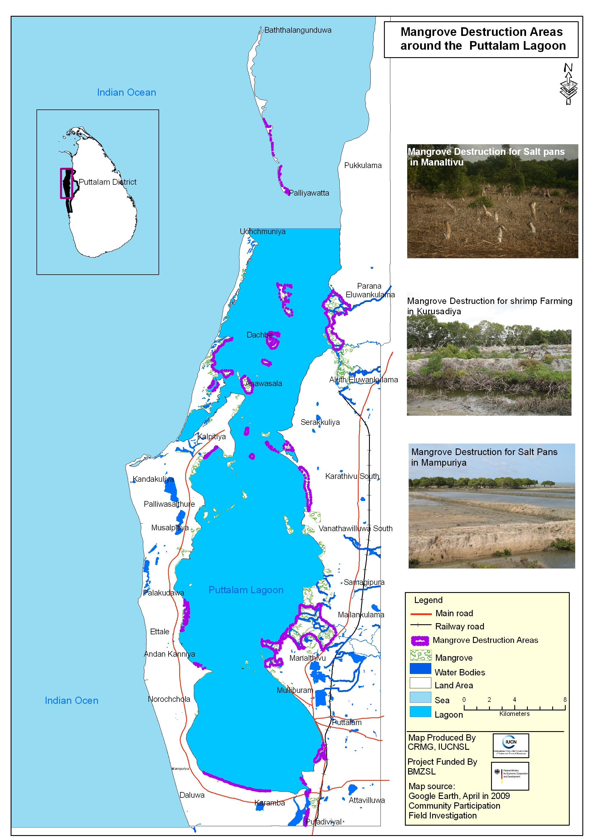
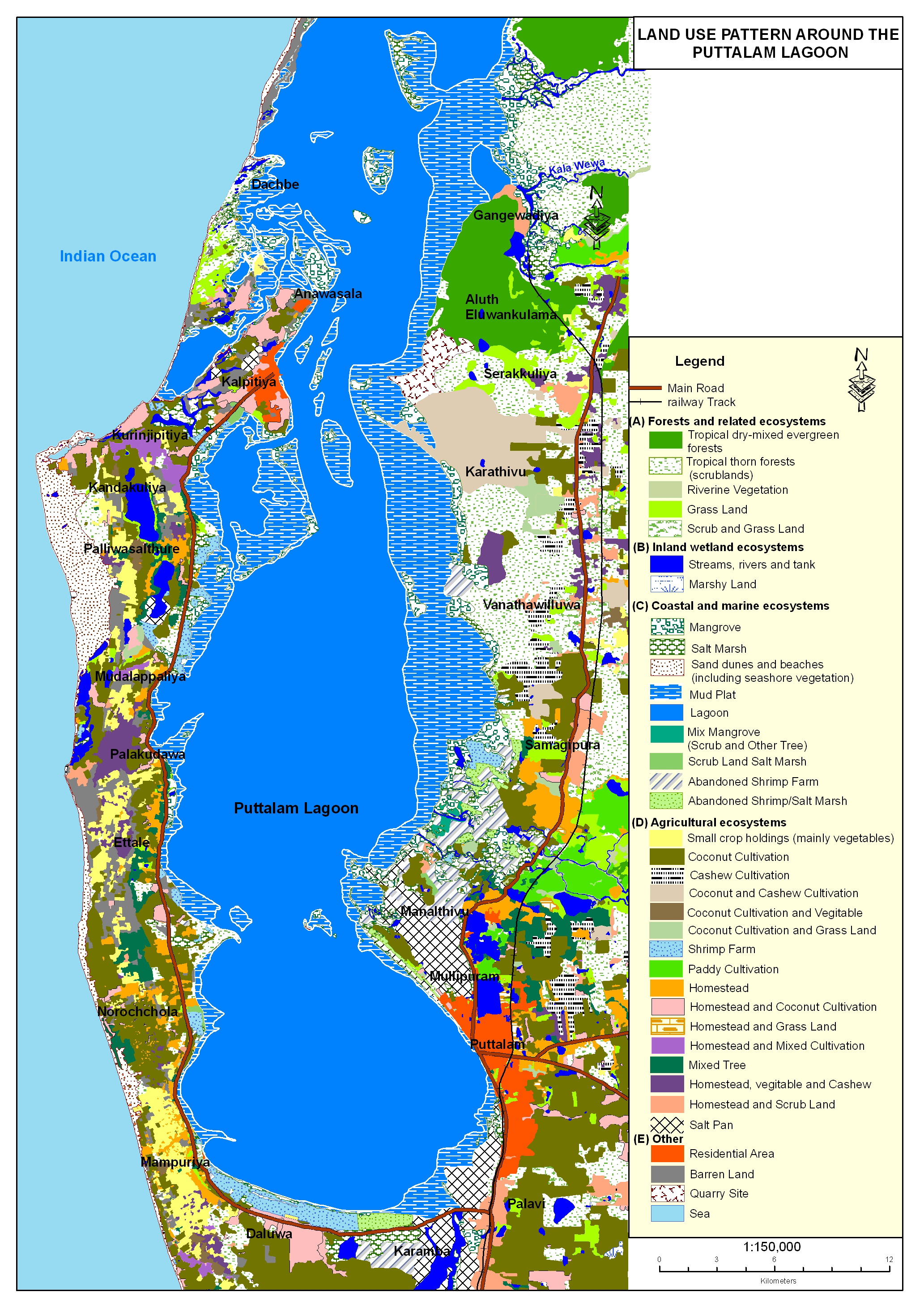
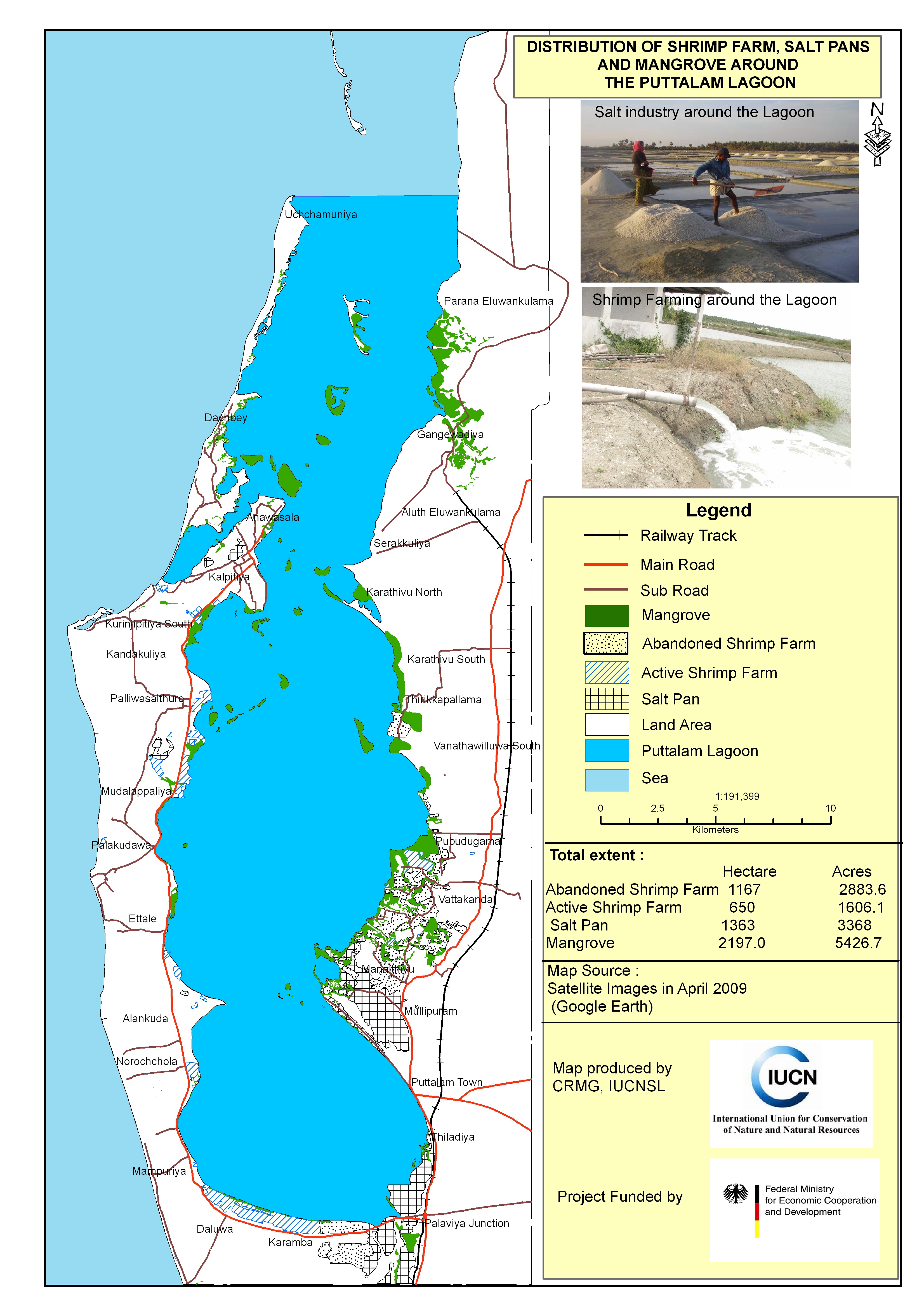
This area obviously offers much potential for multiple land use.The map would be more informative if extents under each land use form are stated. The fact that shrimp farms have failed (exceeding current areas under such farming) obviously raises concern. Why are mangroves being destroyed, a valuable ecosystem in several countries of S.E.Asia where Tiger prawns are being cultured in perpertuity. Very short sighted to destroy such vegetation to produce salt! How about the economics under each landuse form?